

Home > Destinations > New Mexico >Dittert Archaeological Site
Dittert Archaeological Site
 THE FORMERLY TWO STORY HIGH RUIN, CONSISTED OF 30-35 ROOMS AND A CIRCULAR ROOM AND IS NAMED AFTER ALFRED DITTERT JR., WHO EXCAVATED THE SITE.
A kiva is incorporated into the structure. The nearby Armijo Canyon has another 60 archaeological sites. Avoid the area when rain is in the forecast as local roads may become impassable and flash floods may occur.
Dittert Site Overview
Dittert Site & Armijo Canyon Trail
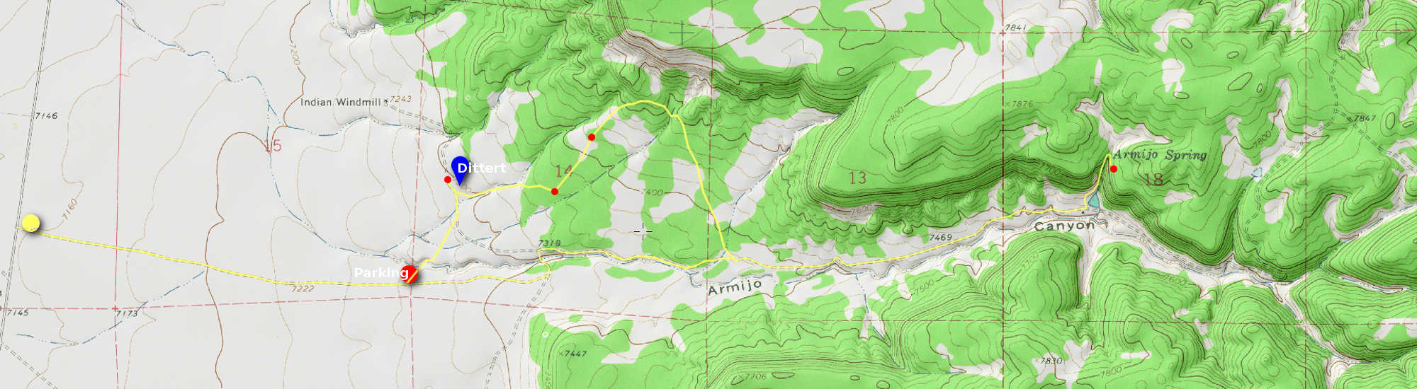 Trail Details:
Cross the fence and hike northeast 0.4 mi. crossing the arroyo, towards the Dittert site. 500 ft. to the northwest is the Burnt Corn Mound. Continue east 0.4 mi. to the ruins of a ranch and then northeast 0.3 mi. to a large circular depression, the Great Kiva. To the northeast is a large rock with petroglyphs. Go south to the dirt road and continue east to the old homestead. Turn north and uphill the west slope of the ravine to the dry spring house. Continue uphill to a lookout point. Follow the arroyo 2.5 mi. to return to the parking area.